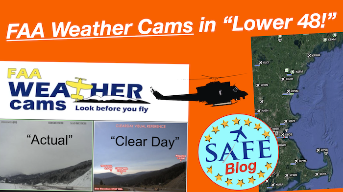
 If you have not seen how effective weather cams can be, please log into the interactive FAA map and pull up a few cameras in an area experiencing challenging weather. This technology is a perfect example of “seeing is believing.” These cameras are sighted at airports and METAR locations but also at strategic “weather chokepoints,”
  like mountain passes. The FAA is busily deploying cameras rapidly in the “Lower 48” after great success in Alaska. Many of these local cameras are supported by EMS operators who benefit greatly from accurate depictions of local conditions at hospital sites. A “lifesaver” in more ways than one.
![]()
With a co-located METAR example below, though the airport METAR is accurate, the camera adds context, showing many of the mountain passes in the distance obscured by clouds. In Alaska testing, these cameras resulted in a 69% reduction in weather-related flight interruptions and an 85% reduction in weather-related accidents; an impressive record. These cameras clearly save lives and adoption by the pilot community has been enthusiastic.

In Maine, the FAA is partnering with LifeFlight of Maine, which provides medevac service throughout the state. This 3rd party service has installed 18 cameras that are up and running. This cooperative venture is adding more continuously and hoping for full coverage soon.
 The FAA’s Weather Camera Program began in Alaska more than 20 years ago. SAFE member Mike Vivion was a long-time Alaska back-country pilot and an advocate for the expansion of this system. There is an estimated potential for over 330 sites in the “lower 48” that would immediately benefit from weather cams. The FAA has been amazingly creative with locating and powering these facilities. Some are obviously powered by the grid and wired connections at hospitals, but many are in remote locations with solar power and satellite uplink connections.
 I flew with a friend in a C-210 up the Alcan to Fairbanks and toured Central Alaska. Transiting to Anchorage through Windy Pass with a stop in Talkeetna really runs you through some challenging weather and terrain; these cameras are a lifesaver.
Obviously, this camera data needs to be added to the synoptic picture and nearest forecast for a complete weather picture, but please add this data to your risk-management decision and share this service with your students! Fly safely out there (and often).
 Enjoy the new courses available to members on the new safe website. And please download and use the (free) SAFE Toolkit App. This contains all the references a working CFI needs plus provides continuously new safety content.
SAFE developed an insurance program just for CFIs! When you are an independent CFI, you are a business (and have legal exposure). This program is the most reasonable but also comprehensive insurance plan you can have (and every agent is a pilot!)
Tell us what *you* think!