
 For safe instrument flight, skills are obviously an essential requirement. But the knowledge component is critical – and often underappreciated. Here are some common weak areas from recent checkrides and IPCs as well as resources to keep you sharp.
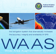
 If you are still treating GPS as a new navigational system, get over it. The first FAA-approved IFR GPS navigator went into service on February 16, 1994; it’s OLD! The regulations are now written “backwards,” defining only the times when you cannot (legally) use GPS (all other times go for it). Some pilots still err on the side of caution chasing wobbly VOR needles for conventional approaches. Life is a lot simpler (and safer) with the steady guidance of GPS and a vertical path indicator. There is a reason they called all those older approaches “non-precision!” Click HERE for a fact sheet on newer RNP approaches. (More FAA Fact sheets HERE.)

 The basic legal guidance for GPS usage is in AIM Chapter One, Section Two. The ICAO term for this class of navigational magic is “Performance Based Navigation” (PBN). Instead of referencing the sensor systems, PBN only specifies the required accuracy for the system. Use whatever you like so long as it provides the “accuracy, integrity, continuity, availability, and functionality needed for the proposed operation in the context of a particular airspace concept.” (And of course it must be FAA-Approved) The guidance is straight forward for enroute operations, but gets a little muddier starting downhill.
AIM 1-2-3(C) Uses of Suitable RNAV Systems. Subject to the operating requirements, operators may use a suitable RNAV system in the following ways.
1. Determine aircraft position relative to, or distance from a VOR (see NOTE 6 below), TACAN, NDB, compass locator, DME fix; or a named fix defined by a VOR radial, TACAN course, NDB bearing, or compass locator bearing intersecting a VOR or localizer course.
2. Navigate to or from a VOR, TACAN, NDB, or compass locator.
3. Hold over a VOR, TACAN, NDB, compass locator, or DME fix.
4. Fly an arc based upon DME.
Search the footnotes in section 2, for more detail and you will do great with hangar flying discussions – or checkride questions – regarding what is legal to fly with your panel-mounted WAAS unit. Obviously “legal” also requires careful verification of databases, manuals, updates, and satellite NOTAMs. This makes preflight and programming a little longer, but the safety and precision make it worthwhile.
So yes, your G-1000 or WAAS GPS can navigate conventional (ground-based) VOR approaches even if “GPS/RNAV” is not mentioned in the approach title. The FAA still requires the navaid to be operational and you must actively monitor it. Your PFD can be GPS/magenta, just keep a VOR source operational/visible. You can even legally navigate all the legs on an ILS right up until just before the final approach fix before switching to “green needles.” In fact, some newer PBN ILS approaches *require* GPS for transitions to final. This is certainly a critical item to ascertain in the pre-brief phase of your flight.

Dig deeper into AC90-108 “Use of Suitable RNAV Systems on Conventional Routes and Procedures” for trickier questions and deeper knowledge. And even better, consult AC 90-119 (still in draft form) for future developments. This AC collects RNAV rules from numerous scattered sources. The YouTube below from Bruce Williams on conventional approaches summarizes all the requirements nicely. This site is a reliable source of IFR wisdom HERE.
With all this focus on the detailed rules regarding GPS, it is important to remember that the GPS constellation can go out of service. Consider your situation if it is suddenly unavailable. (BTW, any jamming is expressly prohibited by the FCC – the people who brought you 5G). GPS has become our “invisible utility” that runs modern society. Cell phones, energy companies and even the stock market depend on GPS (time stamps and system synchronization). So what would happen if we were up in the clouds and GPS went out?
FAA Navigational Redundancy: MON
 The FAA has a plan for this and has extended the service volumes of many VORs to create a system called Minimum Operating Network (MON) using only ground-based navaids. If you noticed some jacked-up high-power VORs around, you are looking at it!
the FAA is retaining a limited network of VORs, called the VOR MON, to provide a basic conventional navigation service for operators to use if GNSS becomes unavailable. During a GNSS disruption, the MON will enable aircraft to navigate through the affected area or to a safe landing at a MON airport without reliance on GNSS. Navigation using the MON will not be as efficient as the new PBN route structure, but use of the MON will provide nearly continuous VOR signal coverage at 5,000 feet AGL across the NAS, outside of the Western U.S. Mountainous Area (WUSMA). AIM 1-1-1
Keep Learning! New Gold Seal IFR Ground School (Free to CFIs)


 Aviation requires us to stay up to date with the continuous changes in knowledge and technology. But nowhere is this more important than with instrument flight (as illustrated above). Every detail counts. Why did they put those two asterisks next to the minimums on that ILS mins? What does that snowflake above mean (Santa)? Preparing for an instrument flight (or preparing for an IFR oral) you have to be totally tuned up and curious to be safe.
SAFE MCFI Russ Still has been working diligently last year researching and building a totally new instrument ground school course. And all his courses are free to CFIs! Every CFI (and any committed pilot) should watch this new course – I guarantee you will learn something new. His fresh animations and content are visually captivating and very worthwhile (and CFIs can track their student’s progress  on the Gold Seal portal). Russ is a talented and committed educator. He really dug into the details and kept a lot of DPEs busy with his detailed questions. The Gold Seal team created an amazing course; try it here (FREE to CFIs). And for everyone else, the free Gold Seal “Know It All” pdf is an excellent review. Fly safe out there (and often)!
 If you buy your holiday gifts from Amazon, please login to Amazon Smile. Jeff Bezos will contribute 0.5% to SAFE if you set it up and this donation costs you nothing!
Join SAFE and enjoy great benefits. You get 1/3 off ForeFlight and CloudAhoy! Your membership also supports our mission of increasing aviation safety by promoting excellence in education (we are an educational not-for-profit).
 Our FREE SAFE Toolkit App puts required pilot endorsements and experience requirements right on your smartphone and facilitates CFI+DPE teamwork. Our CFI insurance was developed by SAFE specifically for CFIs (and is the best protection in the business).
Tell us what *you* think!