The subject of “common weak areas on flight tests” could keep me typing for years, but “IFR flight off the black lines” seems to be a new checkride mystery. Very senior IFR pilots are also often confused on IPCs about the rules and safe procedures for contact and visual approaches. Along with circling approaches, these operations allow for “creative IFR” that have huge safety implications for pilots who misunderstand the rules and risks. Let’s dig into the FAA guidance for visual and contact approaches for some common sense cautions.
 Safety is maintained in the IFR system by flying on FAA-surveyed routes. Unlike the freedom provided in VFR flying, IFR is most commonly stabilized “on the beam” and largely regulated from start to finish. We are safe if we “stay on the black lines” of terminal and approach charts (and avoid nasty weather threats). Consequently, accidents – and scary near misses – often happen in the transition times from IMC to VMC – especially when solid nav. guidance is not provided. “Creative segments” like visual, contact, and circling provide huge risks we need to respect and carefully mitigate.
 Many recent high-profile IFR accidents involved “unguided flight segments” like the 2017 Lear at TEB, Challenger at Truckee, or the Lear 35A at San Diego (the list goes on…) Additionally, in daily IFR flying, flights most often terminate with a visual approach or by canceling IFR early on approach to a non-tower airport. These procedures are not explained well in training and seem to be *never* flown for demonstration. Additionally, flight academies seldom expose learners to the FAA AIM where most of the guidance for these procedures is written. We need to regularly review the procedures and risks.
A visual approach clearance *requires* VFR conditions at the landing airport. A recent CFI-I candidate did not know that and even forgot that in addition to 3sm viz, terminal VFR requires a 1000 ft ceiling to be VFR. This candidate was focused on what a pilot has to do to stay VFR (91.155 cloud clearance). Remember, that even with no airplanes in a Delta, Charlie, or Bravo airspace, a ceiling below 1000 at the airport becomes IFR and you cannot be issued a visual approach clearance. Frequently the clouds also have to be above the minimum vectoring altitude for controllers to issue a visual approach.
AIM 5–4–23 A visual approach is conducted on an IFR flight plan and authorizes a pilot to proceed visually and clear of clouds to the airport. The pilot must have either the airport or the preceding identified aircraft in sight…Cloud clearance requirements of 14 CFR Section 91.155 are not applicable.
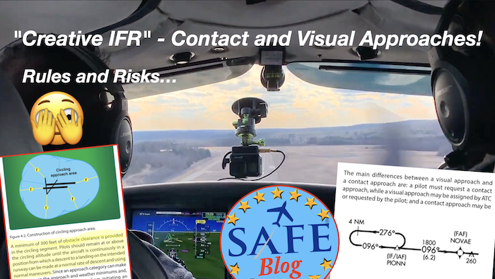
 The visual approach is a segment on an IFR flight plan, assigned or requested, that is flown visually when conditions allow. And though the airport must be VFR, the usual VFR cloud clearances don’t apply. This is not an IFR cancellation; the flight is still on an IFR flight plan (pilots forget to cancel at non-towered fields). An IFR pilot bouncing through a low broken layer of clouds can request and be issued a visual to an airport that is VFR, as long as they are currently clear of clouds and have the field (or preceding aircraft) in sight. This clearance allows an immediate descent at the pilot’s discretion (terrain permitting) and also a shortcut right to the airport. This saves time for both the controller and the pilot but must be conducted carefully since the usual obstacle protection is no longer required to be provided.
The “contact approach” must be requested by the pilot (cannot be assigned) but can be a useful tool when the weather has deteriorated below VFR (down to the basic Class G 1sm CoC). Many professional pilot operating rules prohibit this procedure due to the high risk involved. A scary wake-up call is that the field does not necessarily even have to be in sight. All that is required is a “reasonable expectation” that you can continue to navigate in “Golf-level VFR” and find the field.
AIM 5–4–25 Contact Approach is for “pilots operating in accordance with an IFR flight plan, provided they are clear of clouds and have at least 1 mile flight visibility and can reasonably expect to continue to the destination airport in those conditions, may request ATC authorization for a contact approach.
 A contact approach in low weather is truly “creative IFR” (legal scud running) and comes with a huge dose of risk if performed at an unfamiliar airport. This operation might be acceptable for flying into a familiar field with local knowledge of the terrain and geographic landmarks. I have used a contact only in the case of a “stale ATIS” where the weather has moved out and is quite a bit better than advertised – a fast-moving cold front or clearing fog. In one case the tower was solid IMC and the runway was in the clear. Remember, if your airport is non-towered below the 700/1200 Echo transition, you might be operating in Golf airspace with *everyone* operating 1 mile CoC!
The critical threat to mitigate in both the visual and contact approaches is that there is no nav. or vertical guidance either to the field or for the missed approach in case you re-enter IMC conditions. The AIM recommends using “supplemental navigational guidance,” so keep the airport as the active waypoint. The immediate fallback for penetrating clouds is to power up, climb, and turn toward the field (or lower terrain) for safety. I personally keep a current terrain map active with obstacles displayed for any visual (or night-time VFR) approach.
 The more modern GPS systems include “visual approach” guidance on their systems now. These electronic “visual approaches” were first available on the old Chelton systems and are lately available on the newer Garmin G1000 NXi and Garmin’s GTN units. These can be selected like any other approach (and most annunciate within 10 miles of the field). These can be useful tools to avoid selecting the wrong runway in good VFR. but although they resemble every other approach, no terrain protection is provided. These “visuals” only present a geometric algorithm to a 2.5-mile final on a 3-degree descent path. If the weather is at all questionable, I suggest loading a real approach as “plan B.” Weather is always changing and having an approach – and missed procedure – at the ready is a savvy back-up. Fly safely out there (and often)!
See “SAFE SOCIAL WALL” For more Resources
 Join SAFE and get great benefits. You get 1/3 off ForeFlight and your membership supports our mission of increasing aviation safety by promoting excellence in education. Our FREE SAFE Toolkit App puts required pilot endorsements and experience requirements right on your smartphone and facilitates CFI+DPE teamwork. Our newly reformulated Mentoring Program is open to every CFI (and those working on the rating) Join our new Mentoring FaceBook Group.
Tell us what *you* think!